

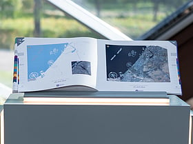
Dubai: Residents can now explore how Dubai has grown from the first map to a global city, after Dubai Municipality launched ‘Dubai Atlas’, a comprehensive geographic and visual resource documenting the emirate’s transformation and offering insights into its future development.
Bringing together geospatial data, maps, and aerial and satellite imagery in a single reference, the publication explores Dubai’s geographical, urban and natural characteristics, infrastructure and community facilities. It aims to give readers a detailed understanding of the emirate’s evolution and distinctive identity.
Get updated faster and for FREE: Download the Gulf News app now - simply click here.
The launch took place during an event organised by Dubai Municipality to celebrate the 25th anniversary of its Geographic Information Systems (GIS) Centre, held under the theme ‘25 Years: From the First Map to the City of the Future’.
Organised to mark World GIS Day, which is observed on the third Wednesday of November, which was November 18 this year, the event highlighted the role of geospatial data in understanding, planning and managing cities, and its contribution to more informed decision-making and future urban development.
Dubai’s changing face
Through maps and aerial and satellite imagery, Dubai Atlas documents the geographical and urban changes that have shaped the emirate over time.