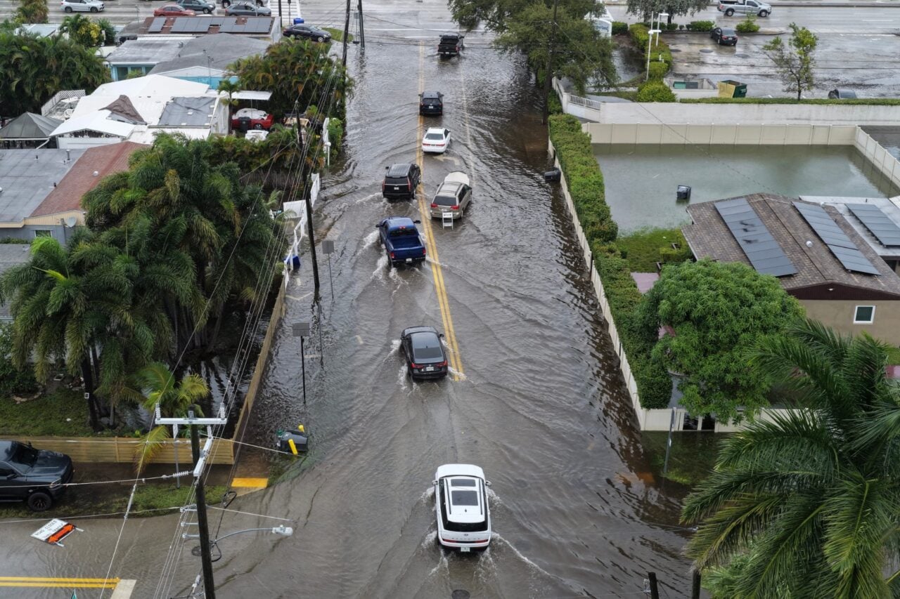
Amid what is usually the state’s dry season, eastern Florida is enduring another round of extreme rainfall and severe, widespread flooding. Meteorologists say the super El Niño is largely to blame for this unseasonably wet weather pattern.
For some parts of the Sunshine State, such as Brevard County and other areas along the Space Coast, this is the second bout of flooding rain in less than three weeks. The first, dubbed a “one-in-1,000-year” rainfall event, triggered catastrophic flash floods, hundreds of water rescues, and killed two people in early November. Communities had little time to recover from that storm before the current deluge descended.
In Florida, parts of Brevard County have received more than 70% of a typical year’s rain from two big storms in the past three weeks.
An estimated 39 inches has fallen, about what D.C. or Chicago typically sees in a full year. pic.twitter.com/qmQyrnDfIt
— Ben Noll (@BenNollWeather) November 19, 2026
The latest photos and videos emerging from eastern Florida show streets and neighborhoods inundated by knee-high water. Flash flooding has forced school closures, evacuations, and water rescues, though no injuries or deaths had been reported as of 1 p.m. ET Thursday. According to the National Weather Service, showers and thunderstorms should continue through Saturday, prolonging the risk of flash flooding.